FlowMap
FLOW MAP – ALL YOU NEED TO KNOW BEFORE YOU GO
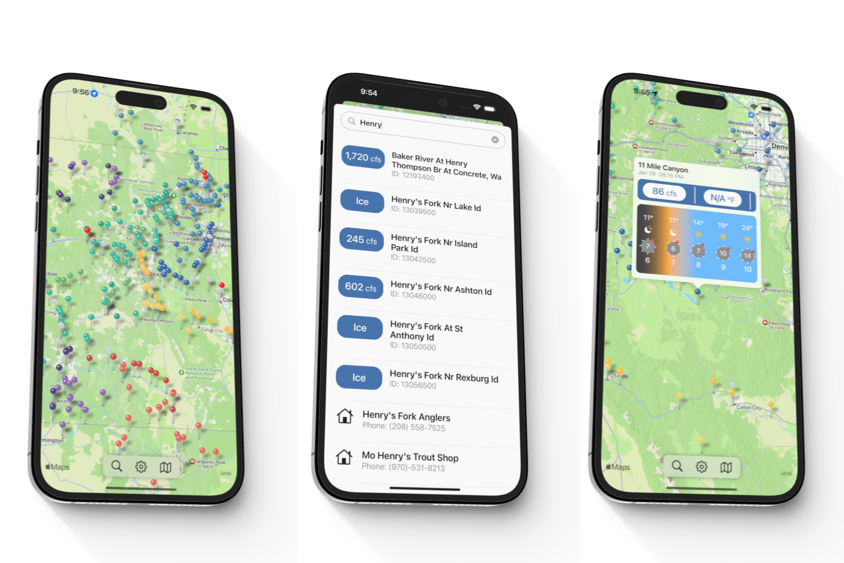
In a world where there’s an app for everything, it’s rare to come across one that really works for fly anglers. FLOW MAP gives you the only three things you should care about when planning your next trip – river flows, weather and the proximity of the nearest fly shop. Let’s face the fact that America’s rivers are no longer predictable. Their flows (measured in cfs), their depth and water temperature can vary wildly, affecting the hatches that can make or break your day. Rivers can close due to low flows and high water temperatures.
FLOW MAP is simple to use, visually appealing and not threatening to even the most Luddite amongst us. One tap on the opening screen takes you to the area you want to visit. A second tap shows current flows and water temperature for the selected river. For the more inquisitive, the recent history of these key data is also just a click away. For some rivers, fishing reports, webcams and access maps can also be found. Clicking on a fly shop icon will give you their phone number and link to their website. The all important “hyperlocal” weather function focusses on the area within 5 miles of the gauge or fly shop – information not readily available from other sources. If your favorite stream is not shown on the app, there is an easy way to ask it to be added.
To put it all in context, a satellite view is easy to display. If you’re the generous type, or just want to arrange a meetup, FLOW MAP can be shared with friends if they have a later model IPhone. FLOW MAP for Android has not been finished yet.
FLOW MAP is $3.99 per year with 1 week free, from the Apple App store.
Give it a try – you won’t regret it.

